
Avenza’s PDF Maps app is free to download and although several maps are free, some map prices are set directly by the map publisher.
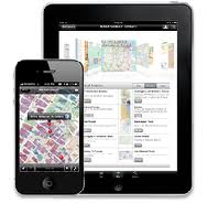
Avenza’s PDF Maps app is a mobile map application that enables you to download thousands of detailed maps directly from map publishers for offline use on your Apple iOS or Android smartphone or tablet.
Here are 5 reasons I like Avenza’s PDF Maps:
1. Scout out the area. I always want to know where I’m going before I get to my cruise port. A lot of ports you can just get off the ship and do something at the pier, but then there are other ports that if you don’t have a game plan – you’re up the creek. I always open my app and figure out my game plan before I arrive in port.
2. Find the beaches. This especially rings true in the Caribbean. A cruise and beach go hand in hand, and if you know where you’re going – you’re set. For example, in Grand Cayman, one of the best beaches on the island is Seven Mile Beach, after I found it on my map.
3. HELP! I’m lost. There’s nothing worse than being lost in port. Last year in Italy I jumped on the wrong bus and it took me two hours outside of town. When I hopped off the bus I just knew I wasn’t going to make it back to the ship. I walked into a bar, and even with the language barrier, the locals pointed me what direction to go to by using the map. I made it back to the cruise with time to spare and it saved a lot of out of pocket expenses of finding my own transportation to the next port.

4. Discover areas off the beaten path. If you’re adventurous, you can use your map to find cool areas and how to get there. Last year I was on Norwegian Cruise Line’s private island Great Stirrup Cay. Great Stirrup Cay has a lighthouse and an airfield on the other side of the island that is unknown to a lot of cruise passengers. With the help of a map, you can venture around the island.
5. Bragging rights. When you get home you can pull the map up and make your friend green with envy when you show them where you been on your last cruise.
The best feature of PDF Maps app is that it does not rely on internet service to relay map data in remote areas –in the mountains, out at sea, or in the air. It uses your device’s built-in GPS to track your location on the map. You can also plot and record information about locations, import and export placemarks/pinpoints, measure distance and area, and even plot photos.